Mastering Hog Hunting Navigation: What You Need to Know
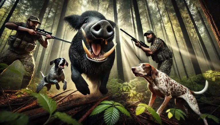
Hog hunting is not just any ordinary outdoor activity; it is a thrilling adventure requiring skill, strategy, and the ability to navigate challenging terrains. The pursuit of these wild boars not only gets the adrenaline pumping but also provides hunters with a unique opportunity to connect with nature and test their mettle. However, in this exhilarating pursuit, navigation in hog hunting plays a pivotal role in ensuring success.
The thrill of hog hunting and the importance of navigation
Embarking on a hog hunting expedition is like entering an unpredictable wilderness where hunters must rely on their instincts, knowledge, and navigational prowess to outsmart these formidable creatures. The thrill of tracking hogs through dense forests or vast open landscapes adds an element of excitement that sets hog hunting apart from other forms of hunting.
But beyond the thrill lies the paramount importance of effective navigation. In hog hunting, proper navigation ensures that hunters can efficiently move through unfamiliar territories while minimizing risks and maximizing opportunities for success.
Knowing how to read maps, use compasses, or navigate using modern tools like GPS devices are all essential skills for any serious hog hunter. Hunters may become disoriented or lose track of their targets without solid navigational abilities, decreasing their chances of making a clean kill.
Navigational challenges in hog hunting
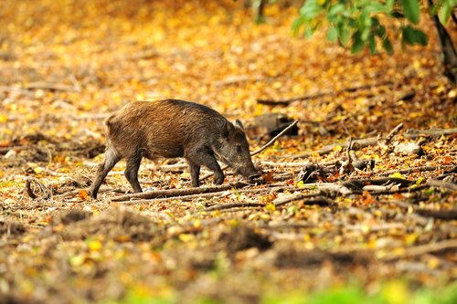
Navigating during a hog hunt presents unique challenges compared to other hunts. Unlike some game animals that generally stick to well-defined trails or territories, hogs are known for their versatility and adaptability to various environments.
They can traverse thick undergrowth, easily cross water bodies, and quickly change direction when threatened. The ever-changing nature of hogs’ habitats makes tracking them more complex.
Dense vegetation hides potential hazards such as fallen trees and treacherous terrain features like sinkholes or marshes that can impede movement. Moreover, hogs are known to be elusive and can cover vast distances quickly, forcing hunters to remain vigilant and adapt their navigation strategies on the go.
In hog hunting, navigating challenging landscapes while staying alert for hog signs and potential ambush points requires keen observation and understanding of the animal’s behavior. Navigational challenges become skill tests, where hunters must employ tools like GPS devices or topographic maps to stay on track while exploiting the weaknesses inherent in hog movement patterns.
Understanding the importance of navigation in hog hunting is crucial for safety and success. The thrill of tracking these wild boars is enhanced by the challenges faced along the way.
By equipping oneself with various navigational tools and techniques, hunters increase their chances of locating hogs efficiently and executing a well-planned hunt. In the following sections, we will delve into different navigational tools like compasses, GPS devices, topographic maps, and advanced techniques like using aerial imagery or telemetry systems to track hogs effectively.
Basic Navigation Tools for Hog Hunting
Compass: The trusty companion for direction-finding
When it comes to hog hunting, a compass is an indispensable tool for navigating through the wild. It is a reliable guide, helping you maintain your bearings and stay on course.
Various types of compasses are suitable for hog hunting, but the most common ones include the baseplate compass and the compass. The baseplate compass is lightweight and easy to use, making it ideal for beginners.
On the other hand, the compass is more rugged and designed specifically for outdoor enthusiasts who need a durable navigation tool in rough terrain. Whichever type you choose, having a dependable compass by your side will greatly enhance your ability to navigate effectively during hog hunts.
How to use a compass effectively in the field
While possessing a compass is essential, knowing how to use it correctly is equally important. To start, familiarize yourself with the basic components of a compass: the magnetic needle that points northward and the rotating bezel containing degree markings. Begin by facing an open area away from metal objects that may interfere with magnetism.
Hold your compass flat in your palm while ensuring it’s level so the magnetic needle swings freely without touching anything. Rotate yourself until the needle aligns perfectly with the North on your bezel.
Now, you have established your orientation! Aim towards specific landmarks or coordinates on maps using your compass bearing to guide precise directions during hog hunting expeditions.
GPS Devices: Modern technology aiding hunters
GPS devices have revolutionized navigation practices for hog hunters worldwide in recent years. These handy gadgets provide accurate positioning information using satellite signals, allowing you to track your location with ease and precision. The advantages of using GPS devices in hog hunting are manifold — they grant real-time updates on your whereabouts, record tracks of your previous hunts, and enable you to mark points of interest (e.g., feeding areas or bedding sites) for future reference.
Additionally, advanced GPS devices offer features like topographic mapping, weather data, and even communication capabilities. With such a wealth of benefits at your fingertips, incorporating a GPS device in your hog hunting arsenal can significantly enhance safety and success in the field.
Recommended GPS devices and their features
When selecting the right GPS device for hog hunting, it’s crucial to consider factors such as battery life, durability, ease of use, and mapping functionalities. Some popular options include Garmin GPSMAP 64th, Magellan eXplorist 710, and Garmin eTrex 30x. These models have proven track records among hunters due to their reliability and comprehensive feature sets.
For instance, the Garmin GPSMAP 64st offers a high-sensitivity receiver for better satellite reception even under dense cover, preloaded topographic maps for seamless navigation through varying terrains, and wireless connectivity for sharing waypoints with other devices. Before making a purchase decision based on personal preferences and budget constraints), ensure that the chosen GPS device aligns with your specific needs as a hog hunter navigating the wild terrain.
Topographic Maps for Hog Hunting Navigation
What are topographic maps?
Topographic maps are detailed representations of a specific area’s physical features, such as hills, valleys, rivers, and vegetation. They provide hunters with valuable information about the terrain they will navigate during hog hunts. These maps use contour lines to illustrate elevation changes, helping hunters understand the land lay and plan their routes accordingly.
Definition and purpose of topographic maps in hog hunting
In hog hunting, topographic maps serve as indispensable tools for navigation. They allow hunters to assess slopes’ steepness, identify hiding spots for hogs, and locate areas likely to hold water or food sources. By understanding the terrain through these maps, hunters can strategize their approach more effectively and increase their chances of success.
Key elements on a topographic map explained.
Topographic maps contain various key elements that aid in navigation during hog hunts. The most crucial element is contour lines, which depict elevation changes.
These lines help determine ridges, valleys, and other prominent landscape features that might impact hunting patterns. Other important information on these maps includes symbols representing water bodies like rivers or ponds and artificial structures like roads or fences that can be used as navigational aids.
Navigating with Landmarks and Natural Features
Identifying landmarks for orientation
Landmarks play a pivotal role in hog hunting navigation by providing reference points for orientation within an area. Prominent natural features like rivers or hills can be reliable markers throughout your hunt. Additionally, artificial structures like fences or roads can be useful landmarks when you must reorient yourself or find your way back to a specific location.
Prominent natural features used as landmarks (e.g., rivers, hills)
When scouting or hunting, rivers and streams are often excellent natural landmarks to keep track of your position, these water bodies tend to carve unique paths through the landscape, and their presence can help you pinpoint areas where hogs might congregate. Hills and ridges also serve as valuable landmarks due to their visibility and impact on hog movement patterns.
Artificial structures as navigational aids (e.g., fences, roads)
Artificial structures like fences and roads offer distinct visual cues that can assist navigation. Fences often demarcate property boundaries as useful markers for tracking hogs or marking hunting zones.
Roads, especially well-traveled ones, provide clear paths to follow or cross during hunts. These landmarks can be invaluable references when exploring unfamiliar territories.
Advanced Techniques for Hog Hunting Navigation
Using aerial imagery and satellite imagery
Advancements in technology have introduced powerful tools for tracking hogs efficiently using GPS and maps. Online mapping tools allow hunters to access detailed aerial imagery and satellite images of the hunting area before heading out. By studying these images, hunters can identify potential hog habitats such as dense vegetation cover or areas with ample food sources.
Utilizing online mapping tools for pre-hunt planning
Online mapping tools allow hunters to examine terrain features from a bird’s-eye view before embarking on a hunt. By zooming in on specific regions of interest, hunters can analyze vegetation density, spot water sources like ponds or swamps, and discover potential travel corridors used by hogs.
Analyzing aerial imagery to locate potential hog habitats
Aerial imagery offers valuable insights into the landscape’s composition that may elude ground-level observation alone. Analyzing these images enables hunters to pinpoint areas where hogs are likely to thrive due to the presence of shelter, food, and water. By identifying hotspots through aerial imagery, hunters can strategically plan their hunting routes and increase their chances of encountering hogs.
Tracking hogs with telemetry systems
Telemetry systems have become popular tools for hunters seeking a more advanced approach to hog hunting navigation. These electronic devices use radio signals to track hogs fitted with transmitters. This technology allows hunters to monitor hog movements in real time and gain insights into their behavior and preferred habitats.
Overview of telemetry systems used in hog hunting
Telemetry systems typically consist of a receiver and a transmitter. The transmitter is attached to the hog, emitting unique radio signals the hunter’s receiver detects. This system provides critical information about hog locations, allowing hunters to adjust their navigation strategies accordingly.
Benefits and limitations of telemetry systems
Hog-hunting telemetry systems offer several advantages, including precise tracking capabilities and understanding of hog behavior patterns. However, these systems have limitations, such as limited range or interference from natural obstacles like dense vegetation or rugged terrain. Hunters should consider these factors when relying on telemetry for navigation purposes.

Safety Considerations
As with any outdoor activity, safety should always be a priority when navigating during hog hunts. Ensure you are well-prepared by carrying essential gear such as first aid kits, communication devices, and appropriate protective clothing.
Familiarize yourself with hunting regulations and always hunt within legal boundaries while respecting private property rights. Stay aware of your surroundings and be cautious while crossing obstacles or navigating challenging terrain features.
Conclusion
Navigating effectively is crucial for a successful hog hunt. Understanding topographic maps assists hunters in assessing terrain features, while contour lines help identify areas conducive to hogs’ presence. Landmarks provide essential orientation points throughout the hunt, whether natural features or artificial structures.
Utilizing advanced techniques like aerial imagery and telemetry systems further enhances navigation capabilities. By utilizing these tools and techniques alongside safety considerations, hunters can confidently embark on their hog hunting journeys, increasing their chances of a fruitful experience in the wild.


